
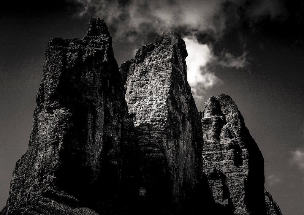
There are few mountain silhouettes in Europe as immediately recognisable as the three towers of the Tre Cime di Lavaredo. The loop that circles them is short, well graded and enormously popular, and for good reason: in about four hours it delivers the north faces from every angle, two huts, a historic battlefield and, with the detour into the Cadini di Misurina, one of the most photographed viewpoints in the Dolomites. It is a day walk rather than a traverse, but it works as a natural warm-up before any longer route in the Sesto and Cortina groups.
Getting to the start
The loop begins at the hut at the end of the toll road above Lago di Misurina, at 2,320 m. The road climbs from the lake at 1,754 m and is open roughly from late May or June until October, depending on snow. Parking at the top is limited and fills early in July and August, and the toll is charged per vehicle, so most walkers either arrive before eight in the morning or take the shuttle bus from Misurina, which runs on a summer timetable. Walking up the road is also possible and adds about 570 m of ascent and an hour and a half each way, which turns a gentle outing into a proper day.
The alternative approach from the north, from the Val Fiscalina near Sesto, is longer and wilder. It climbs the Val Sassovecchio to the hut at the Forcella di Toblin at 2,405 m in about three hours and avoids the road entirely. Combined with the loop it makes a superb 20 km day.
The classic loop, clockwise
From the road end a broad track heads east beneath the south faces, which look surprisingly modest from this side, and reaches the small chapel and the hut at the Forcella Lavaredo, at 2,454 m, in about 40 minutes. This is the first moment of drama. The saddle frames the Cima Grande at 2,999 m, the Cima Ovest at 2,973 m and the Cima Piccola at 2,857 m, and it is here, looking north, that the towers show their true height. The north face of the Cima Grande drops around 500 m to the scree at its foot, vertical or overhanging almost the whole way.
From the saddle the path contours north-west, with the Monte Paterno at 2,744 m on the right, to the second hut at 2,405 m near the Forcella di Toblin. The terrace here faces the north faces squarely and is the view everyone comes for. In the meadow below are three small lakes, the Laghi dei Piani, which reflect the towers on a calm morning and are worth the 20-minute detour.
The return leg drops south-west below the western walls, passes the Malga Langalm at about 2,283 m, where cows graze a few hundred metres from the base of the Cima Ovest, and climbs gently back to the road end. The full circuit is about 10 km with around 400 m of ascent, and most parties take three and a half to four hours without hurrying.
The mountain as a front line
It is easy to walk the loop and never notice that the Monte Paterno is riddled with tunnels, or that the flat ground near the Forcella Lavaredo was once a gun position. From 1915 to 1917 the border between Italy and Austria ran through this landscape, and the two armies dug themselves into the rock on either side of the towers. Today the galleries through the Paterno are open as a protected path, with fixed cables and steps, and the mountain is a small museum of trenches, cave shelters and rusting wire. The traverse takes about two hours from the hut at the Forcella di Toblin and needs a headtorch and a helmet; a harness and a via ferrata set are strongly advised on the exposed sections.
Into the Cadini di Misurina
South of the toll road, on the far side of the parking area, lies a smaller and much less visited group: the Cadini di Misurina, a cluster of slender spires and deep gullies whose name means the basins of Misurina. A well-marked path leaves the road end, contours south for about half an hour with little ascent, and arrives at a narrow ridge that looks straight into the heart of the group. This is the viewpoint that has become famous in recent years, a knife-edge of grass with a wall of spires beyond it. The last few metres are exposed, and on a busy day patience is needed, but the effort is minimal for what is one of the great panoramas of the range.
For a longer day the path continues to the hut inside the Cadini at 2,367 m, about an hour and a half from the road, crossing the Forcella Rinbianco on the way. From there, a longer descent through the Val Popena Bassa returns to Lago di Misurina, and a bus or the road brings walkers back to the start.
Timing, weather and the crowds
The loop is at its best in the first hour after sunrise and in the two hours before sunset, when the light rakes across the north faces and the day-trippers are elsewhere. Staying overnight in one of the two huts on the circuit makes both possible, and reservations are essential from July to mid-September; both huts fill weeks ahead. Half board is the standard arrangement, a sleeping bag liner is required, and dormitory beds are the norm.
Snow lingers on the north side of the Forcella Lavaredo well into June, and the road may open late in a heavy year. In July and August cumulus builds over the towers by early afternoon and thunderstorms are common, so it is wise to be off the Paterno traverse and the Cadini ridge by two o’clock. The clearest skies come in September, when the crowds have thinned and the larches on the slopes above Misurina are turning gold.
- Distance for the loop alone: about 10 km, 400 m of ascent, 3.5 to 4 hours.
- With the Cadini viewpoint added: about 13 km and an extra hour.
- With the Paterno galleries: add two hours, a headtorch and a helmet.
- Best months: late June for snow-dusted faces, September for clear light and quiet paths.
The Tre Cime are as famous as they are for a reason, and the loop is one of those rare walks that lives up to the photographs. Add the Cadini, and the result is a day that shows both the grand and the intimate sides of the Dolomites within a few kilometres of each other.