
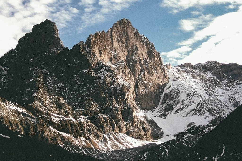
The Picos de Europa are a mountain range that seems to have been dropped in the wrong place. Barely 20 km from the Bay of Biscay, three limestone massifs rise to over 2,600 m out of green Asturian and Cantabrian pasture, so abruptly that sailors once used them as the first sight of land, which is where the name is said to come from. There is no glacier now, but there is everything else: gorges more than 1,000 m deep, sinkholes, karst pavements, a monolith that climbers cross the world to touch, and a network of huts that makes it possible to walk from massif to massif with a light pack. Two walks in particular define the range: the Cares gorge, which cuts between the western and central massifs, and the climb to the Vega de Urriellu, the high meadow at the foot of that monolith.
Three massifs and one national park
The Picos were the site of Spain’s first national park, created in 1918 around the sanctuary at Covadonga and later extended to cover the whole range, about 67,000 hectares across three regions. The western massif, the Cornion, is the greenest and holds the lakes above Covadonga. The central massif, the Urrieles, is the highest and harshest, with the summit of the range, Torre Cerredo, at 2,650 m, and the Picu Urriellu, better known as the Naranjo de Bulnes, at 2,519 m. The eastern massif, the Andara, is lower and quieter, scarred by old mines. Between the first two runs the Cares river; between the second and third, the Duje. Both gorges were carved by water draining north toward the coast through rock that dissolves as readily as it fractures.
The Cares gorge: a path built for water
The Ruta del Cares runs 12 km from Poncebos in Asturias, at about 250 m, to Cain in the province of Leon, at about 460 m, and is walked by more people than any other path in the range. It exists because of a hydroelectric scheme. Between 1916 and 1921 a canal was cut along the western wall of the gorge to carry water to a power station, and the maintenance path beside it, widened in the 1940s, became the trail. The result is a walk unlike any other: a shelf a metre or two wide, blasted into the limestone, that runs almost level for most of its length while the river drops away to more than 200 m below and the walls climb over 1,000 m above.
From Poncebos the path first climbs about 300 m to Los Collados, the only real ascent, then settles onto the shelf. Tunnels, bridges and overhangs follow one another; goats stand on ledges that seem to have no way on or off; griffon vultures turn overhead. Cain, when you reach it, is a village of a few dozen houses squeezed into the end of the gorge, with bars and a road out to the south. Most people walk back the same way, making a 24 km day with modest effort, though a taxi around the massif is a long but real alternative. The path is open all year and at its best in spring and autumn; in July and August the shelf can be crowded and the heat in the gorge is real. There is little shade, no water after the first kilometres, and no barrier along much of the drop.
Bulnes and the climb to the Vega de Urriellu
The approach to the Naranjo begins a few kilometres up the Cares from Poncebos, where a side path climbs the Tejo gorge to Bulnes. This hamlet, at about 650 m, had no road until a funicular railway bored through the mountain in 2001, and it still has none; the old mule path takes about 90 minutes and is the more honest way in. From Bulnes the route continues through the upper village, La Villa, and climbs steeply to the Collado de Pandebano at 1,224 m, where a track from the Sotres side meets it. That alternative start, from the road end above Sotres, shortens the day considerably and is the one most walkers now use.
From Pandebano the path rises through the last beech woods and pasture, then over rock and scree past the seasonal huts at the Majada de la Terenosa, about 1,300 m, before the final zigzags to the Vega de Urriellu at 1,953 m. Allow three hours from Pandebano, five from Bulnes. The meadow is a flat pocket of grass at the foot of the west face of the Naranjo, 500 m of pale limestone that catches the last of the sun long after the meadow is in shadow. The staffed hut here is large by Spanish standards, open from spring to autumn and full most summer nights, and it is the base for both climbers and walkers continuing into the central massif.
Beyond the Vega: into the Urrieles
From the Vega de Urriellu, hut-to-hut walkers have a choice of demanding routes. To the west, a cairned line climbs over the Collada Bonita and across the Jou de los Cabrones to a small hut at about 2,030 m, then on beneath Torre Cerredo into the heart of the massif. To the south, a longer day climbs to the Collado de Horcados Rojos at about 2,340 m and descends either to the top of the cable car above Fuente De, at about 1,823 m, or west to the hut at Collado Jermoso, perched at 2,064 m above the Valdeon valley. These are not paths in the Alpine sense. Waymarks are cairns and faded paint, the ground is karst with holes that would take a walker whole, and cloud comes in from the coast within minutes. A map, a compass and the confidence to turn back are the essential kit.
Seasons, huts and practical matters
The Picos have a wet, maritime climate; the northern slopes receive well over 2,000 mm of rain a year, and fog is the defining hazard rather than heat or storms. The walking season for the high huts runs from about June to October, with July and August the most reliable months and September often the finest. The lower huts and the Cares gorge are accessible for much of the year. Reservations for the Urriellu and Collado Jermoso huts are strongly advised in summer and can be made online; half board is available at both. A short checklist:
- A map at 1:25,000 and a compass, and the habit of checking them before the cloud arrives.
- Waterproofs that actually work, tested before the trip rather than on it.
- Two litres of water for the gorge and more for the karst, where springs are rare.
- A head torch, a warm hat and a sheet sleeping bag for the huts.
The Picos are small enough to cross in three days and complex enough to spend a lifetime exploring. Start with the gorge and the meadow, and you will understand why so many walkers keep returning to this strange island of limestone above the sea.