
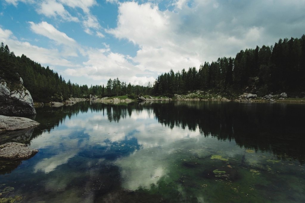
The Prokletije, the “Accursed Mountains”, are the limestone barrier where Montenegro, Albania and Kosovo meet, a range that was closed to walkers for most of the twentieth century and has opened, in the last fifteen years, faster than anyone expected. The Peaks of the Balkans trail is the reason. Waymarked in 2013, it is a loop of about 192 km that crosses the three borders repeatedly, climbs to passes above 2,200 m and descends each evening to a village where a family takes you in. There are no Alpine huts on this circuit in the usual sense. The night’s shelter is a guesthouse, a stone tower house or a shepherd’s summer settlement, and that is the whole point of walking here.
A loop through three countries
The trail is usually walked in ten to thirteen stages, though there is no obligation to complete the loop and most people start from the Albanian side. The circuit passes through the Albanian villages of Theth, Valbona, Cerem and Doberdol, crosses into Kosovo on the Rugova side around Milishevc and Reka e Allages, and then into Montenegro near Babino Polje and the town of Plav, before returning to Albania over the Vusanje side and the pass to Theth. Stages run from 12 to 25 km with 700 to 1,300 m of ascent, and the highest point of the marked route sits at about 2,300 m on the Kosovo-Montenegro border. Marking is a red and white stripe with a small trail emblem, generally good on the Albanian and Kosovo sections and thinner in places on the Montenegrin.
The border permit
The one administrative task that every walker must face is the cross-border permit. Because the trail crosses frontiers away from any official crossing point, each of the three countries requires advance notification of your route, your dates and your identity, and the border police issue a permit that you carry with you. In general terms the application must be lodged at least a week or two in advance, it must cover every crossing you intend to make, and it is normally arranged through a local guiding or tourism office rather than by the walker directly. It is not difficult, but it is not optional, and patrols on the passes do ask to see the paper. Once it is in hand, the frontier is simply a cairn on a col.
Theth to Valbona: the stage everyone walks
If the trail has a single famous day it is the crossing from Theth, at about 750 m, to Valbona, at about 1,000 m, over the Valbona pass at 1,795 m. The distance is around 17 km, the ascent just over 1,000 m, and the time six to eight hours with stops. From the scatter of stone houses and the little church at Theth the path climbs through beech forest, breaks out into meadows below the pass, and finishes on a stony descent into the broad Valbona valley, whose river runs so clear over white gravel that it looks dry from a distance. Drinks are sold from a shepherd’s hut near the pass in summer; there is little water between. Many people walk this one stage alone, having arrived at Valbona by the ferry along the Koman reservoir, a passage of two and a half hours through a fjord-like gorge that is one of the finest approaches to any mountain range in Europe.
The high villages: Cerem, Doberdol, Babino Polje
Beyond Valbona the trail enters a quieter world. Cerem is a hamlet of a few families at about 1,200 m; Doberdol, at around 1,800 m, is a summer settlement of wooden shepherds’ huts that is empty from October to May and where a bed means a mattress on a floor and a meal means whatever the flock and the garden produced that day. The stage between them crosses the Prosllopit pass and the stage beyond Doberdol climbs to the three-country point, from which you look into all three states at once. In Kosovo the path drops through pine forest to the guesthouses of the Rugova side, and in Montenegro it climbs again to the lonely village of Babino Polje before the descent to Plav and its lake, at about 900 m, the one town on the circuit with shops, cafes and a bank.
Above Plav the route turns back toward Albania past Hrid lake, a mountain tarn at nearly 2,000 m in a bowl of beech and pine, and through Vusanje, where the Ropojana valley leads to the Pejes pass and back down to Theth. That final day closes the loop with a descent of more than 1,000 m into the valley where it started.
What a night costs, and buys
The economics are simple and, in general terms, humane. A night in a guesthouse on any part of the trail is charged as half board or full board per person, with dinner, breakfast and a packed lunch, and the price is a fraction of an Alpine hut’s. Hot water is usual in the valleys and rare in the high settlements; electricity in the highest ones comes from a solar panel. Payment is in cash, in euros throughout, since all three countries use or readily accept the currency. Reservations are increasingly necessary in July and August for Theth and Valbona, and increasingly handled by the same offices that process the permits; elsewhere a message a day or two ahead, relayed by the previous host, still suffices. The hospitality is of the old Balkan school: the guest is a duty and a pleasure, the plate is always refilled, and the coffee comes with a glass of the house spirit whether or not you asked.
Season and terrain
- Season: mid-June to early October; the passes hold snow until June and the high settlements empty in October.
- Terrain: limestone karst, with long waterless stretches; carry two litres and refill at every spring.
- Highest summits nearby: Jezerca, 2,694 m, the highest peak of the range, and Zla Kolata, 2,534 m, the highest point in Montenegro, both reached by side trips from the trail.
- Access: Shkoder in Albania is the usual gateway, with buses to Theth and the ferry to Valbona; Podgorica and Pristina serve the other two sides.
The Accursed Mountains have been misnamed. They are severe in outline and mild in welcome, and ten days on the Peaks of the Balkans leaves you with a set of faces and kitchens as vivid as any summit. Walkers come for the passes and remember the doorsteps.