
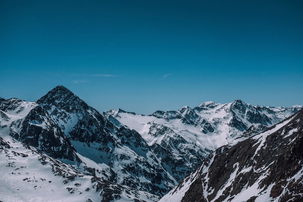
The Stubai Hohenweg is the Austrian answer to the question of what a perfect week of hut walking looks like. It circles the Stubai valley in Tyrol in a great horseshoe, roughly 80 km long, from hut to hut to hut, eight of them in all, and it never drops back to the valley floor until the final afternoon. Each stage climbs to a pass between 2,500 and 2,900 m, looks across to the glaciers of the main ridge, and descends to the next hut in time for a late lunch. The distances are short enough to be enjoyable and the ground is rough enough to be interesting. For a first taste of the Eastern Alps, there is little better.
The horseshoe explained
The Stubai valley runs south-west from Innsbruck for about 35 km, ending in a wall of 3,000 m peaks with the Zuckerhutl at 3,507 m as its highest point. The Hohenweg follows the flanks of the valley on both sides, high above the villages, and crosses the head of the valley beneath the glacier. Walked in the usual direction, from the Starkenburger hut on the west side to the Innsbrucker hut on the east, it climbs a total of a little over 6,000 m over seven or eight stages. The route is graded as a red, or medium, mountain trail throughout, with a handful of black sections where fixed cables protect short rock steps. There is no glacier travel on the standard line.
The eight huts sit between 2,147 m and 2,413 m. Every one of them offers half board, dormitories and, in most cases, a few smaller rooms, and each is reached only on foot. The classic sequence is Starkenburger, Franz-Senn, Neue Regensburger, Dresdner, Sulzenau, Nurnberger, Bremer and Innsbrucker, though many walkers skip the first or last hut to fit the route into a shorter week.
The western flank
Most parties start from Neustift at 1,000 m with a stiff climb of about 1,200 m to the Starkenburger hut at 2,237 m, or shorten it by taking the lift from Fulpmes to the Kreuzjoch and walking across from there. The next morning the trail rounds the Hoher Burgstall, crosses the Seejochl at 2,518 m and drops to the Franz-Senn hut at 2,147 m, the largest and busiest of the eight, at the head of the Oberberg valley. It is a long day, six to seven hours, with the Kalkkogel range, a pale limestone block among darker crystalline peaks, dominating the view behind the walker.
From the Franz-Senn hut the route turns south, crosses the Schrimmennieder at 2,706 m and descends to the Neue Regensburger hut at 2,286 m, which sits on a shelf above a small tarn with the Ruderhofspitze at 3,474 m behind it. The following stage is the highest of the week: a long climb to the Grawagrubennieder at 2,880 m, the summit of the whole route, and a steep, rocky descent to the Dresdner hut at 2,308 m, on the edge of the glacier ski area at the head of the valley. This is the one place where the Hohenweg meets civilisation, with lift cables overhead and a road below, and most walkers are happy to leave it early the next morning.
The eastern flank
The Peiljoch at 2,676 m, marked by hundreds of stone cairns built by passing walkers, leads over to the Sulzenau hut at 2,191 m. It is a short stage, three to four hours, and the afternoon is well spent on the Sulzenau glacier moraine or at the Blaue Lacke, a small lake of startling blue an hour above the hut. The next day climbs past the Grunausee to the Niederl at 2,680 m, a narrow notch with cables, and descends to the Nurnberger hut at 2,297 m, from which the Wilder Freiger at 3,418 m is a popular high-level day for those with time and the right gear.
The Simmingjochl at 2,754 m leads to the Bremer hut at 2,413 m, the highest of the eight and the most remote, in a wild basin of moraine and glacier. Then comes the stage that everyone talks about: Bremer to Innsbrucker, about seven hours with repeated ups and downs across the flank of the Pramarnspitze, cabled sections on smooth slabs, and a final pull to the hut at 2,369 m beneath the Habicht at 3,277 m. It is the longest and hardest day on the route, and also the most beautiful. From the Innsbrucker hut the descent through the Pinnistal valley brings walkers back to Neder and Neustift in about three hours.
Beds, meals and booking
The huts open from late June to late September, with the higher ones, the Bremer and the Dresdner in particular, sometimes starting a week or two later after a snowy winter. All of them require reservations in July and August, and the reservation systems are shared across the Alpine club network, which means an online form for most huts and a phone call for the rest. Members of Alpine clubs pay reduced rates for the bed; everyone pays the same for food. A sleeping bag liner is required, hut shoes are provided, and drinking water is available at every hut. Dinner is a set menu, often with a vegetarian option, and breakfast is simple. Card payment has become common but cash is still wise for the smaller huts.
Practical notes
- Distance: about 80 km with roughly 6,000 m of ascent, in 7 to 8 stages of 4 to 7 hours.
- Highest point: Grawagrubennieder, 2,880 m; the huts lie between 2,147 m and 2,413 m.
- Season: early July to mid-September for the most reliable conditions.
- Escape routes: every hut has a valley path, so bad weather rarely traps a party for long.
Snow on the north sides of the passes is normal into early July, and a light pair of walking crampons or spikes can be useful in the first weeks of the season. Thunderstorms build in the afternoon throughout the summer and the exposed traverse from the Bremer hut is best begun at dawn. The paths are waymarked with the red-white-red stripes of the Austrian trail system and numbered posts at every junction, and route-finding is straightforward in clear weather.
Eight huts, eight nights at an unhurried pace, and a valley that reveals itself one flank at a time. The Stubai Hohenweg has none of the fame of the Dolomites or the Haute Route, and that, as much as the walking, is part of its appeal.