
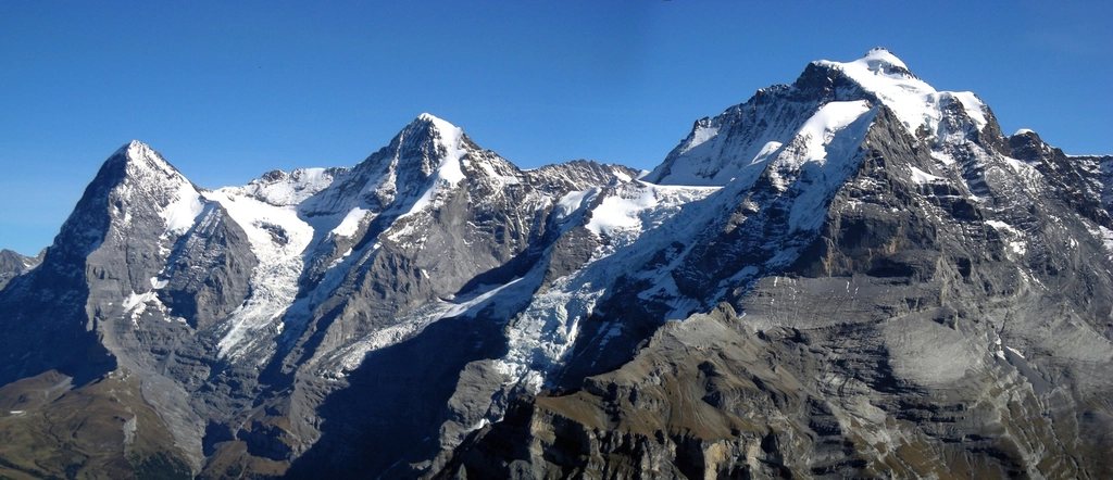
Grindelwald sits at 1,034 m in a green bowl at the foot of the Eiger, and it is one of the few places in the Alps where a walker can step off a train in the morning, spend the day beneath a 1,800 m rock wall, and be back in the village for dinner. The two walks that define the valley could hardly be more different. The Eiger Trail is a short, steep descent along the base of the North Face, close enough to hear the rock. The Schynige Platte to First traverse is a long, high ridge walk that keeps the whole Bernese Oberland skyline in view for six hours. Together they make a two-day introduction to the region that is hard to beat, and both rely on the valley’s remarkable network of railways and cableways rather than on huts.
The Eiger Trail
The Eiger Trail begins at the Eigergletscher station at 2,320 m, on the rack railway between Kleine Scheidegg and the Jungfraujoch, and ends at Alpiglen at 1,616 m on the line back down to Grindelwald. It is only about 6 km long and takes two to two and a half hours, but it drops 700 m and the ground underfoot is rough in places, so it is a genuine mountain path rather than a stroll.
For the first hour the trail runs directly under the North Face, so close that the wall fills the whole upper half of the field of view. This is the face first climbed in 1938, and the route follows the strip of scree and grass at its foot where the climbers of the 1930s pitched their tents. Small plaques mark the history, and on a still morning stones can be heard rattling down the gullies above. The path then swings out across alpine meadow with the Wetterhorn ahead at 3,692 m and drops in long zigzags to the station at Alpiglen. From there the train continues down to Grindelwald in twenty minutes, or a further path descends through the pastures in about an hour and a half.
The trail is usually walkable from mid-June to mid-October. In early summer there can be snow patches in the shaded hollows directly beneath the face, and after heavy rain the upper section is closed for rockfall, so it is worth checking the local trail status board at the station before setting out.
Schynige Platte to First
The second walk begins with a train ride that is an event in itself. The rack railway from Wilderswil, near Interlaken, climbs to the Schynige Platte at 1,967 m in about 50 minutes, using rolling stock from the 1890s that still runs on the original gradient. It operates from late May or June until mid-October. At the top an alpine botanical garden shows several hundred species from the region, and the terrace looks straight across the Lutschine valley to the Eiger at 3,967 m, the Monch at 4,110 m and the Jungfrau at 4,158 m.
The traverse to First is about 16 km with roughly 1,000 m of ascent and 800 m of descent, and it takes six hours at a walking pace with stops. The trail climbs along the ridge past the Oberberghorn, drops to the Sagissee, a small lake in a limestone hollow, and climbs again to the highest point at the Faulhorn, 2,681 m. A historic mountain inn has stood on the summit since 1830, one of the oldest in the Alps, and it still serves lunch and offers beds to walkers who want to split the day and see the sunrise. The view from the top takes in the whole chain from the Wetterhorn to the Blumlisalp, with the lakes of Thun and Brienz spread out to the north.
The descent from the Faulhorn leads past the Bachalpsee at 2,265 m, the lake whose mirrored reflection of the Schreckhorn and the Finsteraarhorn appears on half the postcards in the Oberland, and then along a broad, easy path to the cableway station at First at 2,168 m. From First a gondola drops to Grindelwald in about 25 minutes. Walkers with energy left can continue on foot down through the pastures of Bort and Bachlager instead, adding two hours.
Using the lifts, and paying for them
Both walks depend on transport that is not cheap. The Bernese Oberland runs on a dense mix of rack railways, gondolas and buses, and single tickets for the rides above add up quickly. The region sells multi-day passes that cover most of the lifts and trains around Grindelwald, Wengen and Murren, and for anyone planning three or more days of walking the pass is usually the better deal. Visitors staying in the valley also receive a local visitor card with reductions on some services. Check timetables the evening before: the last descent from First and the last train from Alpiglen are earlier than most people expect, especially outside July and August.
Other days in the valley
Once the two classics are done, Grindelwald offers a week of variations. The Panorama Trail from Mannlichen at 2,343 m to Kleine Scheidegg at 2,061 m is a gentle 4.5 km with the whole Eiger, Monch and Jungfrau wall in view, and it can be combined with the Eiger Trail in one long day. The walk from Grosse Scheidegg at 1,962 m to First follows a balcony path beneath the Wetterhorn. And from Kleine Scheidegg the path to the Eigergletscher station and on to Wengen gives another angle on the face that made the valley famous.
- Eiger Trail: 6 km, 700 m of descent, 2 to 2.5 hours, mid-June to mid-October.
- Schynige Platte to First: 16 km, about 1,000 m of ascent, 6 hours, June to mid-October.
- Highest point: Faulhorn, 2,681 m, with a historic inn on the summit.
- Base: Grindelwald, 1,034 m, reached by train from Interlaken in about 35 minutes.
When to come
July and August bring the most reliable lift timetables and the busiest paths, particularly on the Bachalpsee section, which is a short walk from the First gondola and draws large crowds in the middle of the day. Starting the traverse on the first train from Wilderswil means arriving at the lake in the late afternoon, when most visitors have gone. September is quieter and often clearer, and the larches above Grindelwald turn gold in the first half of October, just before the railways switch to their reduced autumn service. Whatever the month, watch the afternoon: thunderstorms build over the high peaks after two o’clock, and the Faulhorn ridge is not a place to be caught in one.