
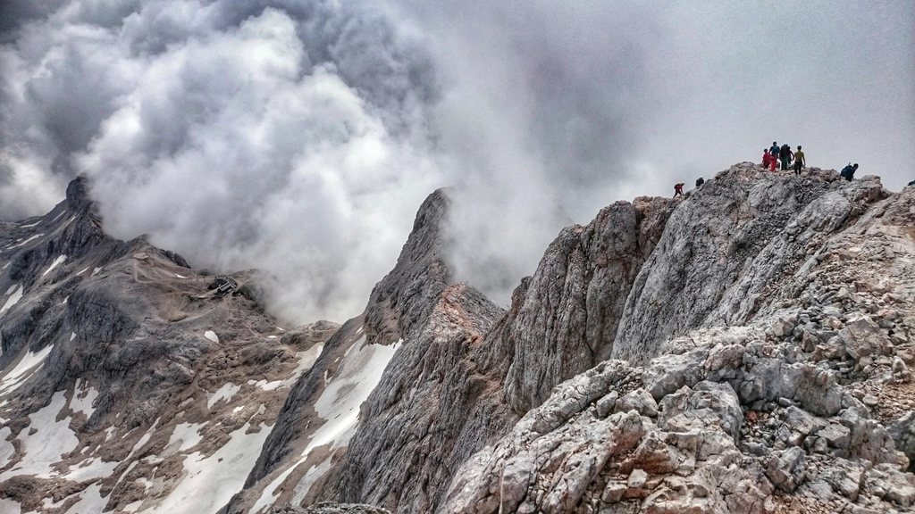
The High Tatras are the smallest high mountains in Europe: a granite crest barely 26 km long on the border of Poland and Slovakia, yet with more than twenty summits above 2,500 m, a scatter of dark tarns and a hut network dense enough that you rarely walk more than four hours between meals. Rysy sits near the middle of it all. Its three-headed summit straddles the frontier; the middle head, at 2,503 m, is Slovak, while the north-western head, at 2,499 m, is the highest point in Poland. It is the only summit in the range where you can cross from one country to the other on a marked path, and one of the few accessible without a guide from both sides. The ascents from Poland and from Slovakia could hardly be more different in character.
Two countries, two ways of running a hut
The Tatras are protected as national parks on both sides of the border, and the two parks manage their trails and huts with distinct habits. On the Polish side the huts are large, sociable and historic, sitting at the head of valleys that are also day-trip destinations; the hut at Morskie Oko, at about 1,410 m, receives hundreds of thousands of day visitors a year on the road from Zakopane. Dormitory places are cheap, bookings for the popular huts are taken months ahead in summer, and there is a long tradition of letting late arrivals sleep on the floor of the dining room when the beds are gone. A small entrance fee to the park is collected at the trailheads.
On the Slovak side the huts are smaller, higher and more spread out, and several of them are supplied on foot by porters who carry loads of 60 kg or more up the trail on wooden frames. The highest of them all, the hut below Rysy at about 2,250 m, has no road, no cable car and no helicopter deliveries in the normal course of things; everything on the menu came up on someone’s back. Slovak trails above the huts are closed by regulation from the beginning of November to the middle of June, which fixes the season with unusual clarity.
From Poland: Morskie Oko and the chains
The Polish ascent begins at the Morskie Oko lake, at 1,395 m, itself reached by a 9 km walk on a closed asphalt road from the car park at Palenica Bialczanska. Most hikers stay the night at the hut on the lakeshore or at the trailhead and start at dawn. The path circles the lake, climbs a rock step to Czarny Staw pod Rysami, the black tarn at 1,583 m, and then takes the granite slabs above in earnest. The upper section is equipped with chains where the angle steepens, and on a busy day a queue forms at each one.
Allow four hours from the lakeshore to the summit, about 1,100 m of ascent, and three hours back down. There is no hut between the lake and the top, so the day is long and exposed; snow lingers in the upper gully well into June, and an early season ascent can involve snow slopes where the chains are still buried.
From Slovakia: Popradske pleso and the highest hut
The Slovak ascent starts from the lake at Popradske pleso, 1,494 m, which is itself a walk of roughly an hour and a half from the railway halt at Strbske Pleso, at 1,346 m. The path climbs the Mengusovska valley to a second tarn, then steepens toward the hut below Rysy, perched on a shelf at 2,250 m. From the hut it is a further hour on a good but airy path, with a short chained step, to the saddle and the summit. The whole ascent from Popradske pleso is about 1,000 m and takes four hours; overnight at the hut it breaks into an easy afternoon and an even easier dawn.
The hut is tiny, with a few dozen places, and its short season, from mid-June to the end of October, makes it one of the most sought-after beds in the range. It offers the classic Tatra evening: a bowl of soup, a plate of dumplings, and a sunset over the whole Slovak side of the crest, with the plain of the Poprad far below.
Linking the huts: a week on the crest
Rysy is only the headline. The pleasure of the High Tatras is to string the huts together, and the Slovak side lends itself to a linear traverse along the Tatranska magistrala, a waymarked route of about 46 km that runs the length of the range at around 1,500 to 2,000 m, dipping to the valley resorts and climbing to the huts in turn. A comfortable itinerary looks something like this:
- Strbske Pleso to Popradske pleso and the hut below Rysy, with the summit the next morning.
- Back down and along the magistrala to the hut in the Velicka valley, at about 1,670 m, beneath Gerlach.
- Over the Polsky hreben pass, at 2,200 m, to the hut in the Velka Studena valley, at 1,960 m.
- The Priecne saddle, with chains, to the hut in the Mala Studena valley, at 2,015 m, and down to the resort at Stary Smokovec.
- Along the eastern end of the crest to the hut by the Green Lake, at 1,551 m, and out to Tatranska Lomnica.
Each stage is a long half day, which leaves time for a summit or a tarn on the way. The Polish side offers a parallel version, linking the hut at Hala Gasienicowa, at 1,500 m, the hut in the Valley of Five Polish Lakes, at 1,670 m, and Morskie Oko, with the crossing of the Zawrat pass and the descent past the Siklawa waterfall, at over 60 m the highest in the Polish Tatras.
Timing, weather and the border
The season is short on both sides. Snow can lie on the Rysy chains until the middle of June and return by the second half of September; the settled weeks are July and August, which are also the crowded ones. Afternoon storms are the daily rhythm: the Tatras stand alone above the plains and gather cloud with remarkable speed, so summits are for the morning. Crossing the border on the summit involves no formality at all, both countries being in the same passport-free area, but it does involve a change of trail regulations, and it is worth knowing which side’s rules you are walking under.
The most practical advice for Rysy is this: climb it from Slovakia and sleep at the hut, then descend into Poland and sleep by the lake. That shows both hut cultures of the range in a single day, and which one suits is a matter of taste.