
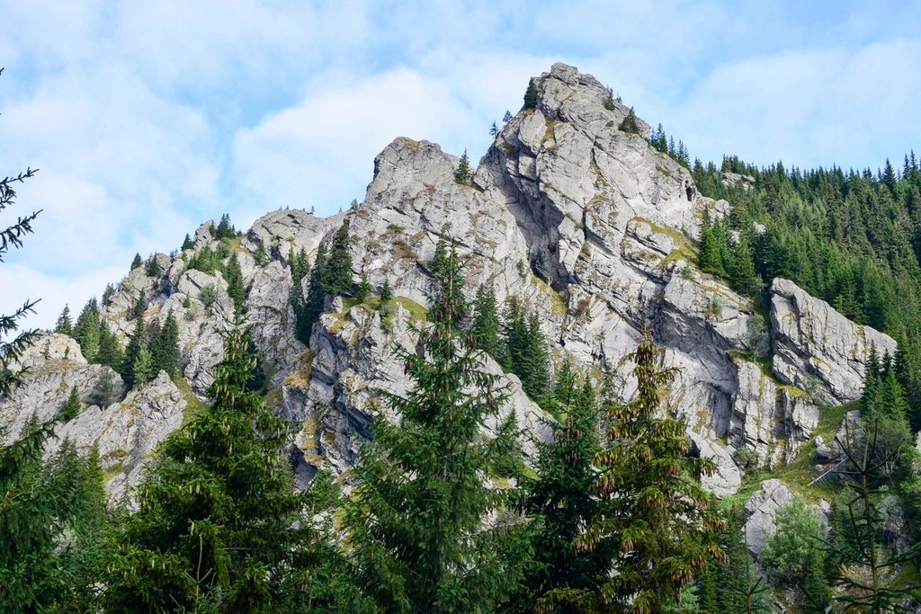
The Fagaras force a rethink of what “hut-to-hut” means. For roughly 70 km, from the Olt gorge in the west to the Rucar-Bran corridor in the east, a single crest holds above 2,000 m with barely a break, and along it stand not the plump timber huts of the Alps but a thin chain of staffed cabanas in the valleys and unstaffed metal refuges on the ridge itself. Moldoveanu, at 2,544 m the highest summit in Romania, sits two thirds of the way along. To reach it on foot is to commit to the ridge, to sleep high, and to carry more than you would in Slovenia or Switzerland. It is also among the finest long ridge walks in Eastern Europe.
Geography of a wall
Seen from the Transylvanian plain to the north the Fagaras are a wall, rising 2,000 m in a few kilometres with dozens of parallel glacial valleys cut into the face. The south side, toward Wallachia, is longer and gentler. The crest between is a series of grassy saddles and rocky summits: Negoiu at 2,535 m, Vistea Mare at 2,527 m, Moldoveanu just beyond it, and a dozen more above 2,400 m. There are around 40 glacial tarns, and the crest is marked from end to end by a red stripe on white, the “banda rosie” that Romanian hikers follow across all their main ridges.
The one road crossing, the Transfagarasan, climbs to a tunnel at just over 2,040 m beside Balea lake, at 2,034 m. It is open in general terms from the beginning of July to the end of October, and it splits the ridge conveniently into a western half and an eastern half, each a walk of three to four days.
Cabanas below, refuges above
The Romanian mountain accommodation system has two layers. The cabanas are staffed lodges, usually at 1,400 to 2,100 m, at the heads of the valleys: places like the cabana in the Podragu cirque, at 2,136 m the highest staffed one on the ridge, or the cabanas at Negoiu, Balea lake, Valea Sambetei and Urlea. They serve hot food and beds, with reservations advisable in August but rarely essential. The refuges, the “refugii”, are another matter: small metal or fibreglass shelters on the crest, unstaffed and free, with a platform to sleep on and nothing else. The refuge at Calun, at 2,135 m beneath Negoiu, the refuge on the saddle at Portita Vistei below Moldoveanu, and the one at Berevoescu at the eastern end are the ones that make a full traverse possible.
The consequence is that a Fagaras traverse is a hybrid: half board where a cabana falls on the day’s route, self-catering in the refuges, and a sleeping bag and stove in the pack at all times. Wild camping is tolerated on the ridge, and many Romanian hikers simply pitch by the tarns. Water is the chronic problem; the crest is dry for hours at a stretch, and the tarns and the springs just below the saddles are the only sources.
The western half: Turnu Rosu to Balea
The classic full traverse starts from the Olt valley near Turnu Rosu and climbs, over a long first day, to the cabana at Suru, at 1,450 m. From there the crest is gained and followed east over Budislavu and Ciortea, past the refuge at Calun, and on to Negoiu, whose summit involves the ridge’s one notorious passage: the Strunga Dracului, the “Devil’s Gap”, a steep chimney fitted with a chain, or its easier bypass, the Strunga Doamnei. From Negoiu a long day of ups and downs leads across Laita to the Balea saddle and the lake, where the road, the cabanas and, in season, the crowds of the Transfagarasan reappear. Three days is the norm for this half, with nights at Suru or Barcaciu, at the Calun refuge, and at the Negoiu cabana.
The eastern half: Balea to Moldoveanu and beyond
From Balea lake the crest climbs east over Iezerul Caprei and drops to the Capra saddle before the long, high stretch toward the Podragu cirque. The cabana there is the natural base for the summit: from it the trail climbs to the crest at the Podragu saddle and follows the ridge east over Tarata and Ucea Mare to Vistea Mare. Moldoveanu is a short spur off this summit, a fifteen-minute walk along a narrow ridge, and the highest point in Romania is marked by nothing more than a small metal sign. Allow four to five hours from Podragu to Moldoveanu with a daypack, seven to eight hours for the round trip.
Beyond Moldoveanu the crest continues past the refuge at Portita Vistei, over Galasescu and Gainatu, to the descent at Valea Sambetei, with its cabana at 1,401 m, and on to Urlea and Berevoescu for those completing the full traverse to the Rucar-Bran corridor. Most walkers settle for a five-day version: Balea to Podragu, Moldoveanu, down to Sambata, out.
Bears, dogs and weather
Three things distinguish the Fagaras from an Alpine walk, and each deserves a sentence. Brown bears are present in the forests on both flanks; they are not a hazard on the open ridge, but food should be hung or stored away from the tent below the tree line, and it is sensible to make a little noise in the forest sections at dawn and dusk. Shepherd dogs guard the summer flocks on the grassy slopes below the crest; they are large, they are serious, and the correct response is to stop, keep walking poles low, and let the shepherd call them off. Weather is the third: the Fagaras catch every front from the west, thunderstorms build by early afternoon in July and August, and there is nowhere to hide on a 2,400 m grass ridge. A sound rule is to be on the crest by seven and off the high points by one.
When to go and how to plan
The walking season runs from late June, when the last snow leaves the north-facing saddles, to early October, when the first returns. September is often the best month: the storms are fewer, the shepherds are packing up, and the ridge is a rust-coloured line under a hard blue sky. Access is by train to Sibiu or Brasov and then local buses or taxis to the trailhead villages: Turnu Rosu, Avrig, Arpasu de Jos, Victoria, Sambata de Sus. Rescue is provided by the national mountain rescue service, whose stations sit at the main cabanas, and their emergency number is the same across the country. Pack for five nights, carry two litres of water from every source, and keep a day in hand: the ridge has a way of adding one.