
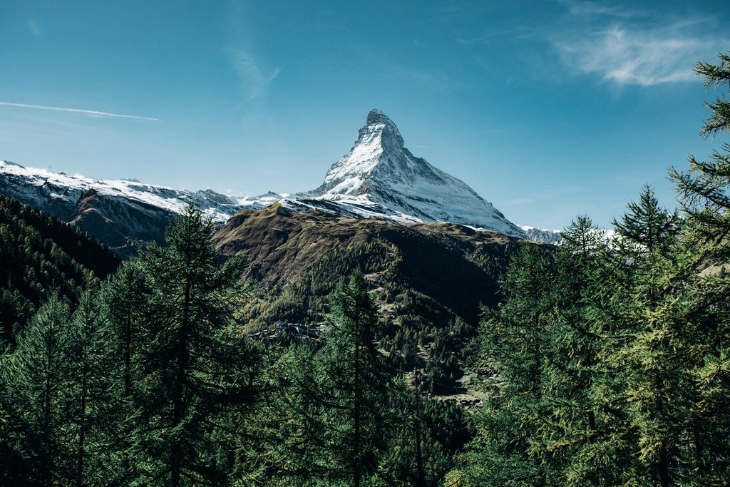
The Walker’s Haute Route links the two most famous mountains in the Alps, Mont Blanc at 4,808 m and the Matterhorn at 4,478 m, by way of eleven passes above 2,000 m and some of the most varied high country in Switzerland. It starts in Chamonix at 1,035 m and ends in Zermatt at 1,600 m, covers about 200 km, and climbs something close to 12,000 m along the way. Most walkers take twelve to fourteen days. It is longer, higher and considerably harder than the Tour du Mont Blanc, and it never crosses a glacier on the standard line, which is exactly what makes it one of the finest two-week walks in Western Europe.
A route built from passes
The shape of the Haute Route is simple: a chain of deep valleys running north to south, crossed one after another from west to east. Every day climbs to a col, drops into the next valley, and finishes at a hut or a village with a bed. The passes get higher and the valleys emptier as the route moves into the Valais. Col de Balme at 2,191 m on the first day, on the border between France and Switzerland, gives the first look back at the Mont Blanc massif. The Fenetre d’Arpette at 2,665 m on the second day is a rocky notch above the Trient glacier and the first serious test of the legs; the easier Bovine variant at 1,987 m is the sensible choice in bad weather or with late snow.
The heart of the route lies between Verbier and Arolla. From the hut on the Mont Fort at 2,457 m the trail crosses the Col Termin at 2,648 m, the Col de Louvie at 2,921 m and the Col de Prafleuri at 2,965 m in a single long day, the highest and most committing of the whole traverse. The following stage walks the length of the Lac des Dix, one of the largest reservoirs in Switzerland, and climbs to the Pas de Chevres at 2,855 m, where a set of steel ladders bolted to the rock leads over the final step. Walkers who dislike ladders take the Col de Riedmatten at 2,919 m instead, a scree gully a few hundred metres to the north.
The Valais and its side valleys
East of Arolla the route enters the string of parallel valleys that give the Valais its character. From La Sage, the Col du Tsate at 2,868 m leads over to the Moiry valley and its hut at 2,825 m, which sits directly above the crevassed tongue of the Moiry glacier and is one of the most dramatic places to sleep on the whole route. Then the Col de Sorebois at 2,835 m drops into Zinal, the Forcletta at 2,874 m crosses into the Turtmann valley and the tiny hamlet of Gruben, and the Augstbordpass at 2,894 m brings the trail down to St. Niklaus in the Mattertal.
These are big days: 1,000 to 1,400 m of ascent, a similar descent, six to eight hours of walking. They are also the days when the Haute Route rewards persistence most generously. The Weisshorn at 4,506 m, the Zinalrothorn and the Dent Blanche appear and disappear as the route crosses from valley to valley, and for two or three stages walkers may not meet another person between breakfast and the hut.
The Europaweg finish
From St. Niklaus the final two days follow the Europaweg, a balcony path high on the east side of the Mattertal that was built in the late 1990s. It is spectacular and it is also unstable. Rockfall has closed sections repeatedly, and the trail has been rerouted several times, most notably with a 494 m suspension bridge above Randa that opened in 2017 to bypass a dangerous gully. The hut on the Europaweg at 2,220 m splits the section in two, and the second day ends with the Matterhorn filling the view straight ahead as the path drops into Zermatt.
When the Europaweg is closed, or when the weather is poor, the valley path from St. Niklaus through Randa and Tasch is the standard alternative. It is less exciting but perfectly pleasant, and it is far better than a two-day wait for a trail that may not reopen.
Beds along the way
The Haute Route mixes mountain huts with village accommodation more than most Alpine traverses. Roughly half the nights are spent in huts, usually at 2,200 to 2,900 m, with half board, dormitories and a sleeping bag liner required. The other nights are in villages such as Champex, Le Chable, Arolla, Zinal and Gruben, where small guesthouses and dormitory lodgings take the place of the hut. Booking ahead is essential everywhere from early July to the end of August, and the huts at Prafleuri and Moiry in particular fill fast. Most huts take reservations online or by phone and ask for a deposit; village beds are easier to change at short notice.
Cash is still useful in the higher huts, though card payment has spread quickly in recent years. Dinner is typically a soup, a main course and a dessert, breakfast is bread, butter, jam and coffee, and a packed lunch can usually be ordered the night before.
Season and snow
The season runs from early July to mid-September. Before July the highest passes, especially Prafleuri, Riedmatten and the Augstbordpass, usually hold snow on their north sides, and after mid-September the huts begin to close and the first autumn storms can shut the passes for days. Late July and August bring the most stable weather and the most people; the first two weeks of September are often the best window, with cool mornings, clear air and beds that are easier to find.
- Distance: about 200 km, with roughly 12,000 m of ascent and 10,000 m of descent.
- Duration: 12 to 14 days, with rest days possible in Champex, Arolla or Zinal.
- Highest point: Col de Prafleuri, 2,965 m.
- Hardest stage: Mont Fort to Prafleuri, three passes and about eight hours.
The Haute Route is not a walk to take lightly, and it is not a sensible first hut-to-hut trip. But for anyone who has done the Tour du Mont Blanc or the Alta Via 1 and wants more, longer, higher and quieter, there is nothing quite like the moment the Matterhorn appears above the larches on the last afternoon.